Here comes the heat
A large marine heatwave, dubbed The Blob, developed off the western coast of North America in 2013 and lingered to the middle of 2016. This map shows satellite measurements of ocean surface temperatures, with colours indicating values higher (red) and lower (blue) than the average from 2003 to 2012. The slider compares temperatures in April 2014 with those in March 2015.
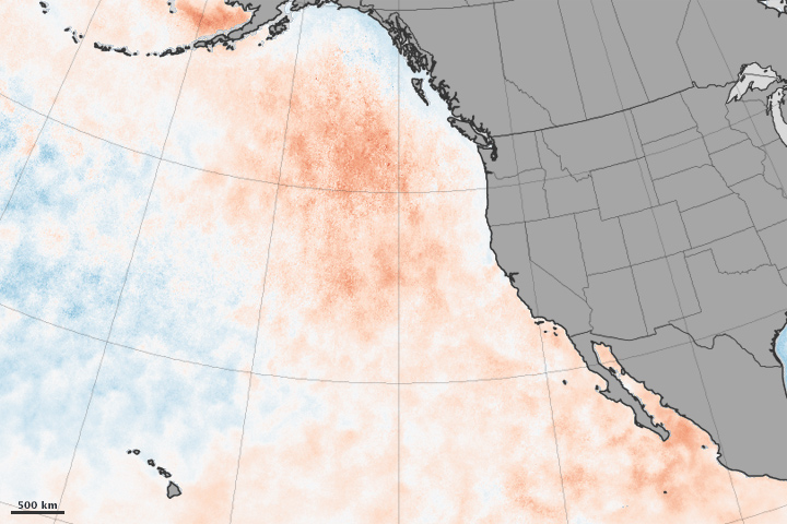
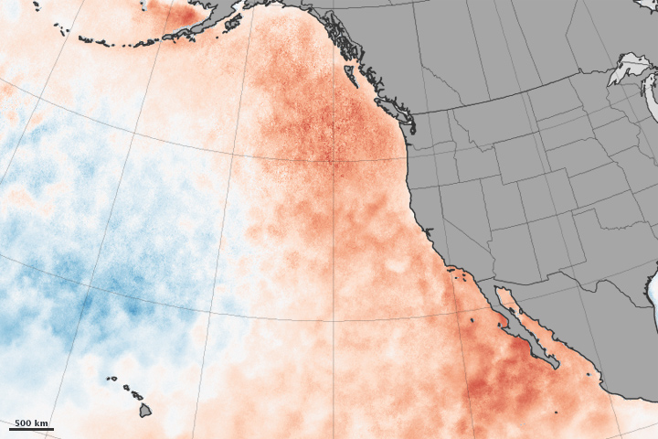
Credit: NASA Earth Observatory image by Jesse Allen, using MOI-SST data from Chelle Gentemann and Frank Wentz, Remote Sensing Systems.